Home > Mary Evans Prints Online > New Images August 2021
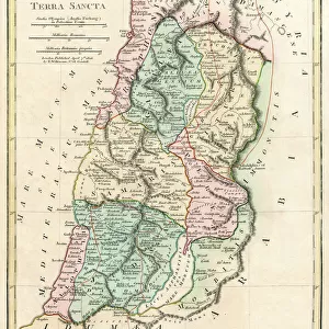
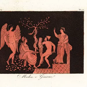
Map of Palestine, circa 1800

![]()
Wall Art and Photo Gifts from Mary Evans Picture Library
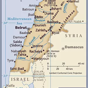
Map of Palestine, circa 1800
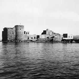
Map of Palestine, circa 1800. From Gaza and Ashkelon in the south to Tyre and Sidon (Lebanon) in the north. La Palestina. Handcoloured copperplate engraving after Giulio Ferrario in his Costumes Ancient and Modern of the Peoples of the World, Il Costume Antico e Modern o Story, Florence, 1833
Mary Evans Picture Library makes available wonderful images created for people to enjoy over the centuries
Media ID 23384782
© Florilegius
1800 1800s Antico Camel Ferrario Gerusalemme Giulio Jerusalem Luigi Mayer Moderno Palestine Parts Peoples Pilgrims Rama Ramla Isreal Ottoman Rovine
FEATURES IN THESE COLLECTIONS
> Africa
> Egypt
> Related Images
> Arts
> Artists
> F
> Giulio Ferrario
> Asia
> Lebanon
> Lebanon Heritage Sites
> Tyre
> Asia
> Lebanon
> Related Images
> Mary Evans Prints Online
> New Images August 2021
EDITORS COMMENTS
This exquisitely detailed handcoloured copperplate engraving, created around 1833, offers a captivating glimpse into the geography and history of the Holy Land, specifically the region known as Palestine, during the 1800s. The map extends from the southern cities of Gaza and Ashkelon, through the central regions of Ramla and Lydda, to the northern borders of Tyre and Sidon in present-day Lebanon. The map, titled "La Palestina," is an intricate representation of the land's topography, featuring various ruins, roads, and settlements. The illustration showcases the rich history of the region, with the remains of ancient Roman, Byzantine, and Ottoman structures scattered throughout the landscape. One can identify several notable sites, such as the ruins of Ramla, known as the "Roman City," and the holy city of Jerusalem, with its iconic Dome of the Rock and Church of the Holy Sepulchre. The map also reveals the presence of various pilgrimage routes, as indicated by the winding roads and the occasional camel caravan. This map, taken from Giulio Ferrario's "Costumes Ancient and Modern of the Peoples of the World," provides a fascinating window into the historical and cultural significance of Palestine during the 1800s. The meticulous handcolouring and copperplate engraving techniques add to the map's allure, making it an essential addition to any collection focusing on the history, fashion, or geography of the Middle East during this period.
MADE IN THE USA
Safe Shipping with 30 Day Money Back Guarantee
FREE PERSONALISATION*
We are proud to offer a range of customisation features including Personalised Captions, Color Filters and Picture Zoom Tools
SECURE PAYMENTS
We happily accept a wide range of payment options so you can pay for the things you need in the way that is most convenient for you
* Options may vary by product and licensing agreement. Zoomed Pictures can be adjusted in the Cart.