Home > Europe > Netherlands > Maps
Map / France / Belgium / Nethe

![]()
Wall Art and Photo Gifts from Mary Evans Picture Library
Map / France / Belgium / Nethe
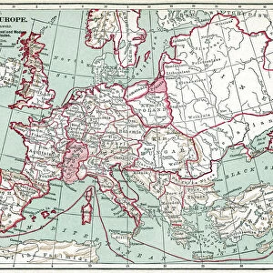
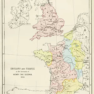
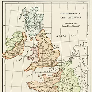
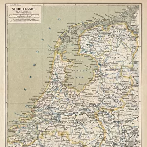
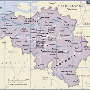
Map of France, Belgium and the Netherlands
Mary Evans Picture Library makes available wonderful images created for people to enjoy over the centuries
Media ID 608787
© Mary Evans Picture Library 2015 - https://copyrighthub.org/s0/hub1/creation/maryevans/MaryEvansPictureID/10113948
FEATURES IN THESE COLLECTIONS
> Europe
> Belgium
> Related Images
> Europe
> Netherlands
> Maps
> Europe
> Netherlands
> Posters
> Europe
> Netherlands
> Related Images
> Europe
> Related Images
> Maps and Charts
> Early Maps
EDITORS COMMENTS
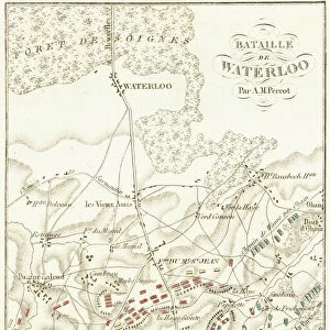
This early 20th century map print depicts the territories of France, Belgium, and the Netherlands in Europe. The intricate details of the map show the political boundaries of these countries during a significant period in European history. France, located in the western part of the map, is shown in its full extent, including its metropolitan regions and overseas territories. The map highlights the major cities of France, such as Paris, Marseille, Bordeaux, and Lyon, as well as significant geographical features like the Alps, the Massif Central, and the Rhine River. To the north of France lies Belgium, a small but historically important country. The map reveals the division of Belgium into its three regions: Flanders in the north, Wallonia in the south, and Brussels, the capital city, in the center. The map also shows the major rivers of Belgium, including the Meuse, the Scheldt, and the Rhine. The Netherlands, located to the northeast of Belgium, is shown in its full extent, including the provinces of North and South Holland, Zeeland, and Friesland. The map highlights the major cities of the Netherlands, such as Amsterdam, Rotterdam, and The Hague, as well as significant geographical features like the North Sea, the Rhine River, and the Wadden Sea. This map offers a fascinating glimpse into the political and geographical landscape of Europe during the early 20th century, a time of significant change and development in the history of France, Belgium, and the Netherlands. The intricate details of the map provide valuable insights into the historical context of this region and offer a visual representation of the complex interconnections between these countries and their shared history.
MADE IN THE USA
Safe Shipping with 30 Day Money Back Guarantee
FREE PERSONALISATION*
We are proud to offer a range of customisation features including Personalised Captions, Color Filters and Picture Zoom Tools
SECURE PAYMENTS
We happily accept a wide range of payment options so you can pay for the things you need in the way that is most convenient for you
* Options may vary by product and licensing agreement. Zoomed Pictures can be adjusted in the Cart.