Home > Europe > United Kingdom > England > London > Boroughs > Enfield
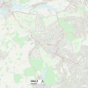
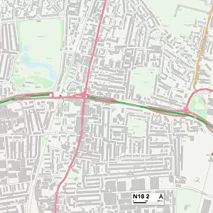
Enfield N11 2 Map

![]()
Wall Art and Photo Gifts from Map Marketing
Enfield N11 2 Map
Postcode Sector Map of Enfield N11 2
Media ID 19975637
Amethyst Close Bailey Close Bexhill Road Blake Road Bosworth Road Bowes Road Brownlow Road Edith Road Edwards Drive Enfield Evesham Road Gordon Road Goring Road Hastings Road Lancaster Road Lynton Gardens Maidstone Road Natal Road North Way Oak Lane Ollerton Road Park Grove Park Road Queens Road Shrewsbury Road South Way Stanley Road Station Road The Drive Tredegar Road Union Road Wakefield Road Warwick Road Winton Avenue Woodfield Way York Road A109
FEATURES IN THESE COLLECTIONS
> Animals
> Mammals
> Bovidae
> Goral
> Architecture
> Tunnels
> Arts
> Artists
> P
> Gordon Parks
> Europe
> United Kingdom
> England
> London
> Boroughs
> Enfield
> Europe
> United Kingdom
> Wales
> Gwent
> Tredegar
> Map Marketing
> Postcode Sector Maps
> N - London N
> Maps and Charts
> Related Images
MADE IN THE USA
Safe Shipping with 30 Day Money Back Guarantee
FREE PERSONALISATION*
We are proud to offer a range of customisation features including Personalised Captions, Color Filters and Picture Zoom Tools
SECURE PAYMENTS
We happily accept a wide range of payment options so you can pay for the things you need in the way that is most convenient for you
* Options may vary by product and licensing agreement. Zoomed Pictures can be adjusted in the Cart.