Home > Arts > Landscape paintings > Waterfall and river artworks > River artworks
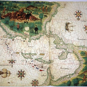
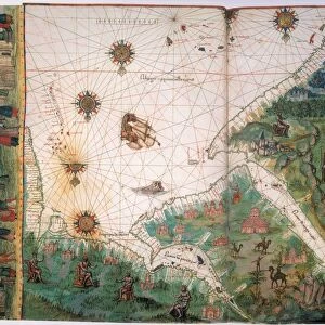
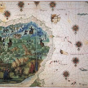
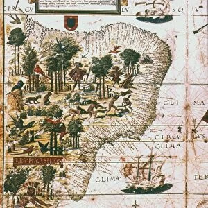
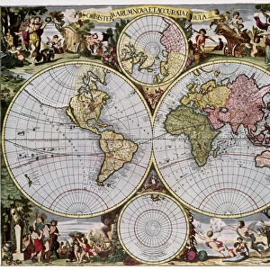
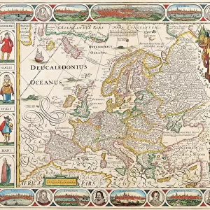
WORLD MAP. English map of the world from 1651

![]()
Wall Art and Photo Gifts from Granger
WORLD MAP. English map of the world from 1651
Granger holds millions of images spanning more than 25,000 years of world history, from before the Stone Age to the dawn of the Space Age
Media ID 6622409
1651 Asia Europe New World North America South America World
FEATURES IN THESE COLLECTIONS
> Arts
> Landscape paintings
> Waterfall and river artworks
> River artworks
> Asia
> Related Images
> Europe
> Related Images
> Granger Art on Demand
> Maps
> Maps and Charts
> World
> North America
> Related Images
> South America
> Related Images
EDITORS COMMENTS
This print showcases a remarkable piece of history, the "WORLD MAP. English map of the world from 1651". Transporting us back in time to the 17th century, this intricately detailed map offers a glimpse into how our ancestors perceived and understood the world. Created by The Granger Collection, renowned for their exceptional artistry and historical accuracy, this print is a true treasure. The map itself is an exquisite representation of its era. With delicate calligraphy labeling each continent and ocean, it invites exploration with every glance. From Europe to Asia, North America to South America, all regions are meticulously depicted with rivers gracefully winding through vast landscapes. What makes this particular map even more fascinating is its depiction of the "New World" showcasing early European knowledge of North and South America during that period. It serves as a testament to mankind's insatiable curiosity and relentless pursuit of discovery. As we admire this stunning print from Granger Art on Demand, we can't help but be reminded of how far we've come since 1651. It sparks contemplation about our ever-evolving understanding of geography and our place within it. Whether displayed in a classroom or adorning your home decor, this print will undoubtedly captivate viewers with its rich historical significance and timeless beauty.
MADE IN THE USA
Safe Shipping with 30 Day Money Back Guarantee
FREE PERSONALISATION*
We are proud to offer a range of customisation features including Personalised Captions, Color Filters and Picture Zoom Tools
SECURE PAYMENTS
We happily accept a wide range of payment options so you can pay for the things you need in the way that is most convenient for you
* Options may vary by product and licensing agreement. Zoomed Pictures can be adjusted in the Cart.