Home > Europe > United Kingdom > Wales > Flintshire > Broughton
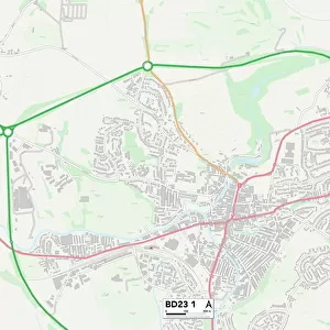
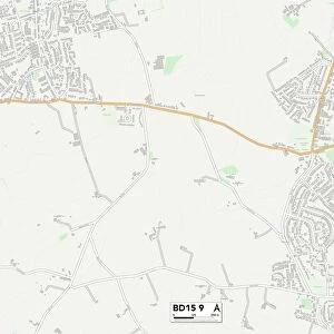
Craven BD23 5 Map

![]()
Wall Art and Photo Gifts from Map Marketing
Craven BD23 5 Map
Postcode Sector Map of Craven BD23 5
Media ID 19966044
Acre Lane Back Lane Bank Lane Brook Street Causeway Chapel Croft Chapel Fold Chapel Lane Chapel Street Church Lane Crag View Craven Edge Lane Far Lane Gordale Close Green Lane High Bank High Green High Lane Highcroft Hillside Close Hillside Drive Intake Lane Kiln Drive Limekiln Lane Long Lane Low Lane Main Street Mere Lane Middle Lane Mill Lane Monks Road Moor Lane Mossdale New Road Orchard Lane Park Lane Park View Drive Rowan Lane Springfield Court Springfield Road Station Road The Drive The Green Thorpe Lane Tinkers Lane Walden Road Water Street Wood Lane Arncliffe Brooklyn Buckden Cray Grassington Hebden Kettlewell Litton Rakes
FEATURES IN THESE COLLECTIONS
> Europe
> United Kingdom
> Wales
> Flintshire
> Broughton
> Map Marketing
> Postcode Sector Maps
> BD - Bradford
> Map Marketing
> UK Maps
> Maps and Charts
> Related Images
MADE IN THE USA
Safe Shipping with 30 Day Money Back Guarantee
FREE PERSONALISATION*
We are proud to offer a range of customisation features including Personalised Captions, Color Filters and Picture Zoom Tools
SECURE PAYMENTS
We happily accept a wide range of payment options so you can pay for the things you need in the way that is most convenient for you
* Options may vary by product and licensing agreement. Zoomed Pictures can be adjusted in the Cart.