Home > Europe > United Kingdom > Northern Ireland > County Antrim > Lisburn
Trafford M16 8 Map

![]()
Wall Art and Photo Gifts from Map Marketing
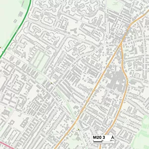
Trafford M16 8 Map
Postcode Sector Map of Trafford M16 8
Media ID 19975775
Arnold Road Athol Road Bedford Avenue Blair Road Blenheim Avenue Burford Avenue Burford Road Cambridge Avenue Carlton Road Churchill Avenue Clarendon Road College Road Dudley Road Granville Avenue Green Walk Grosvenor Road Hazel Avenue Highbury Road Holden Avenue Manley Road Manor Avenue May Road Mayfield Road Palmerston Avenue Range Road Rowan Avenue Royston Avenue Russell Avenue Russell Road St Austell Road Stanley Road Trafford Victoria Road Waltham Road Wellington Avenue Wellington Road Whalley Avenue Whalley Road Whitby Avenue Wilbraham Road Withington Road Wood Road Woodgate Road Woodlands Road
FEATURES IN THESE COLLECTIONS
> Europe
> United Kingdom
> Northern Ireland
> County Antrim
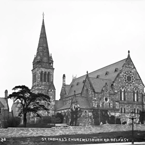
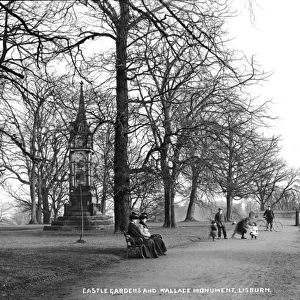
> Lisburn
> Europe
> United Kingdom
> Northern Ireland
> County Down
> Lisburn
> Europe
> United Kingdom
> Scotland
> Highlands
> Alness
> Map Marketing
> Postcode Sector Maps
> M - Manchester
> Maps and Charts
> Related Images
MADE IN THE USA
Safe Shipping with 30 Day Money Back Guarantee
FREE PERSONALISATION*
We are proud to offer a range of customisation features including Personalised Captions, Color Filters and Picture Zoom Tools
SECURE PAYMENTS
We happily accept a wide range of payment options so you can pay for the things you need in the way that is most convenient for you
* Options may vary by product and licensing agreement. Zoomed Pictures can be adjusted in the Cart.