Home > Europe > Denmark > Maps
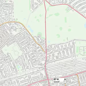
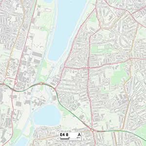
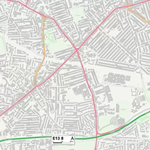
Newham E13 8 Map

![]()
Wall Art and Photo Gifts from Map Marketing
Newham E13 8 Map
Postcode Sector Map of Newham E13 8
Media ID 19970217
Abbey Street Anne Street Barclay Road Beatrice Close Beaumont Road Belgrave Road Bennett Road Braemar Road Brock Road Caraway Close Chalk Road Cherry Tree Way Chesterton Road Columbia Road Crofton Road Croydon Road Cumberland Road Denmark Street Esk Road Falcon Street First Avenue Foster Road Frank Street Gardner Road Garfield Road Glen Road Graham Road Herbert Street Jellicoe Road Jones Road Kent Street Khartoum Road King Street Larch Close Lincoln Road Luton Road Mayfield Road Newham Newman Road Palmer Road Philip Street Seaton Close Second Avenue Selby Road St Andrews Road Surrey Street Sussex Street Sutton Road Third Avenue Upland Road Whitwell Road Woodside Road Plaistow
FEATURES IN THESE COLLECTIONS
> Europe
> Denmark
> Related Images
> Europe
> United Kingdom
> England
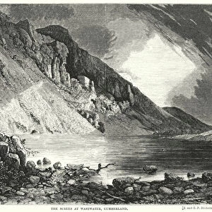
> Cumberland
> Europe
> United Kingdom
> England
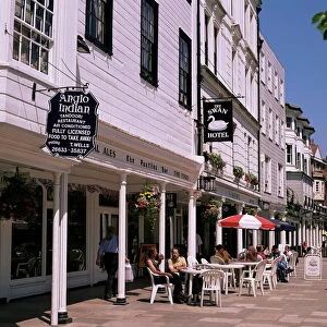
> Kent
> Bobbing
> Europe
> United Kingdom
> England
> Kent
> Chalk
> Europe
> United Kingdom
> England
> Kent
> Kent Street
> Europe
> United Kingdom
> England
> Kent
> Luton
> Europe
> United Kingdom
> England
> Kent
> New Barn
> Europe
> United Kingdom
> England
> Kent
> Sutton
> Map Marketing
> Postcode Sector Maps
> E - London E
MADE IN THE USA
Safe Shipping with 30 Day Money Back Guarantee
FREE PERSONALISATION*
We are proud to offer a range of customisation features including Personalised Captions, Color Filters and Picture Zoom Tools
SECURE PAYMENTS
We happily accept a wide range of payment options so you can pay for the things you need in the way that is most convenient for you
* Options may vary by product and licensing agreement. Zoomed Pictures can be adjusted in the Cart.