Home > Europe > United Kingdom > Wales > Powys > Newtown
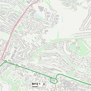
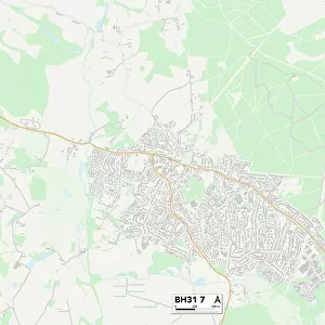
Poole BH12 3 Map

![]()
Wall Art and Photo Gifts from Map Marketing
Poole BH12 3 Map
Postcode Sector Map of Poole BH12 3
Media ID 19965508
Albion Close Almond Grove Bassett Road Blackburn Road Brook Road Burley Road Catherine Close Chatsworth Road Churchill Crescent Consort Close Cottage Gardens Cranbrook Road Crest Road Croft Road Curtis Road Granville Road Grove Road Hillcrest Road Jackson Road Jasmine Close Lawson Road Linden Road Livingstone Road Lucas Road Marie Close Newtown Paddock Close Petworth Close Poole Rachel Close Ringwood Road Rosemary Gardens Rosemary Road Sea View Road Shirley Road St Clements Road St Georges Avenue Stanfield Road Sylvan Road Upper Road Virginia Close Wesley Road
FEATURES IN THESE COLLECTIONS
> Europe
> United Kingdom
> Scotland
> Aberdeenshire
> Blackburn
> Europe
> United Kingdom
> Scotland
> West Lothian
> Blackburn
> Europe
> United Kingdom
> Wales
> Powys
> Newtown
> Map Marketing
> Postcode Sector Maps
> BH - Bournemouth
> Maps and Charts
> Related Images
MADE IN THE USA
Safe Shipping with 30 Day Money Back Guarantee
FREE PERSONALISATION*
We are proud to offer a range of customisation features including Personalised Captions, Color Filters and Picture Zoom Tools
SECURE PAYMENTS
We happily accept a wide range of payment options so you can pay for the things you need in the way that is most convenient for you
* Options may vary by product and licensing agreement. Zoomed Pictures can be adjusted in the Cart.