Home > Arts > Artists > A > John White Alexander
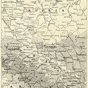
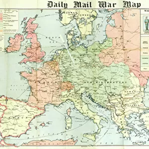
Map of Poland Showing Russian Territory Occupied by Germany in August, 1915, 1916

![]()
Wall Art and Photo Gifts from Heritage Images
Map of Poland Showing Russian Territory Occupied by Germany in August, 1915, 1916
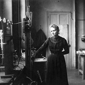
Map of Poland Showing Russian Territory Occupied by Germany in August, 1915, 1916. By the end of 1915, the Germans had occupied the entire Russian sector, including Warsaw. From " The War Illustrated Album De Luxe - Volume IV. The Summer Campaign - 1915", edited by J. A. Hammerton. [The Amalgamated Press, Limited, London, 1916]
Heritage Images features heritage image collections
Media ID 19660903
© The Print Collector/Heritage Images
Album Amalgamated Press Amalgamated Press Limited Amalgamated Press Ltd Full Frame Galicia Hammerton Hammerton J A Hammerton Ja Hammerton Sir John Alexander J A Hammerton Ja Hammerton John Hammerton Occupied Territory Poland Polish Sir John Alexander Sir John Alexander Hammerton Sir John Hammerton Strategic Strategy Summer Campaign 1915 Territorial Territory The Amalgamated Press The War Illustrated Warsaw Warsaw Poland
FEATURES IN THESE COLLECTIONS
> Animals
> Mammals
> Cats (Domestic)
> Russian White
> Arts
> Artists
> A
> John White Alexander
> Arts
> Artists
> W
> John White
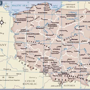
> Europe
> Poland
> Related Images
> Historic
> World War I and II
EDITORS COMMENTS
This print showcases a historical map titled "Map of Poland Showing Russian Territory Occupied by Germany in August, 1915,1916". Capturing a close-up view of the map, it offers a glimpse into the strategic military occupation during World War I. The image is sourced from "The War Illustrated Album De Luxe - Volume IV. The Summer Campaign - 1915" edited by J. A. Hammerton and published by The Amalgamated Press Limited in London in 1916. By the end of 1915, German forces had successfully occupied the entire Russian sector depicted on this map, including Warsaw. This territorial acquisition marked a significant turning point in the war as Germany strategically expanded its control over Polish lands. Galicia, another region highlighted on the map, was also under German occupation during this period. The print provides valuable insight into an important chapter of history that shaped Europe's geopolitical landscape during the early twentieth century. It serves as a reminder of the immense impact and consequences brought about by World War I.
MADE IN THE USA
Safe Shipping with 30 Day Money Back Guarantee
FREE PERSONALISATION*
We are proud to offer a range of customisation features including Personalised Captions, Color Filters and Picture Zoom Tools
SECURE PAYMENTS
We happily accept a wide range of payment options so you can pay for the things you need in the way that is most convenient for you
* Options may vary by product and licensing agreement. Zoomed Pictures can be adjusted in the Cart.