Home > North America > United States of America > New York > New York > Maps
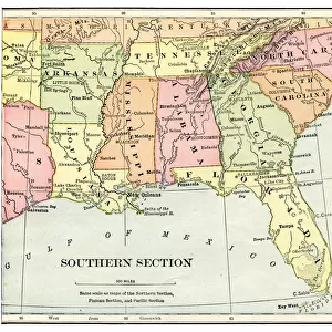
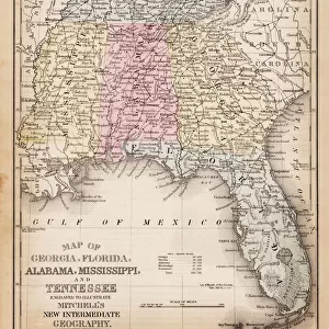
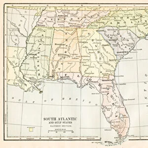
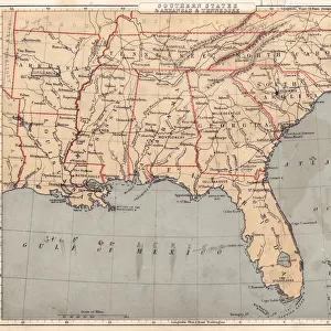
Map of Southern States 1875

![]()
Wall Art and Photo Gifts from Fine Art Storehouse
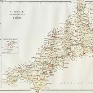
Map of Southern States 1875
Elementary Geography Course by William Swinton - New York 1875
Unleash your creativity and transform your space into a visual masterpiece!
THEPALMER
Media ID 20114779
© A 2014 Roberto Adrian Photography
FEATURES IN THESE COLLECTIONS
> Fine Art Storehouse
> Map
> Historical Maps
> Maps and Charts
> Related Images
> North America
> United States of America
> New York
> New York
> Maps
> North America
> United States of America
> New York
> Related Images
EDITORS COMMENTS
In this print titled "Map of Southern States 1875" we are transported back in time to the rich history of America's southern region. The map, originally featured in William Swinton's Elementary Geography Course published in New York in 1875, offers a glimpse into the intricate details and geographical nuances of that era. The image showcases an exquisite reproduction by THEPALMER from Fine Art Storehouse, allowing us to appreciate the fine craftsmanship and attention to detail. The warm sepia tones evoke a sense of nostalgia, enhancing our connection with the past as we explore this historical artifact. As we examine the map closely, it becomes evident that it serves not only as a geographical guide but also as a window into cultural diversity and societal dynamics during that period. It highlights major cities, rivers, mountain ranges, and state boundaries meticulously drawn by hand—an art form rarely seen today. This print invites us to reflect on how much has changed since 1875 while appreciating the enduring beauty and significance of our shared heritage. Whether displayed in classrooms or homes alike, this piece sparks curiosity about our collective past and fosters an appreciation for cartography as both an artistic expression and educational tool. "The Map of Southern States 1875" is more than just a visual representation; it is a testament to human ingenuity and exploration—a timeless reminder of where we have been and how far we have come.
MADE IN THE USA
Safe Shipping with 30 Day Money Back Guarantee
FREE PERSONALISATION*
We are proud to offer a range of customisation features including Personalised Captions, Color Filters and Picture Zoom Tools
SECURE PAYMENTS
We happily accept a wide range of payment options so you can pay for the things you need in the way that is most convenient for you
* Options may vary by product and licensing agreement. Zoomed Pictures can be adjusted in the Cart.