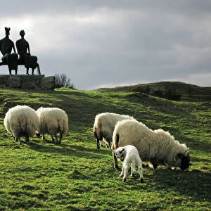
Home > Animals > Farm > Sheep > Related Images
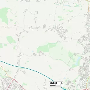
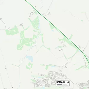
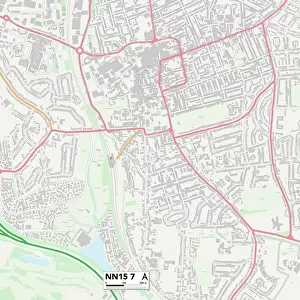
Wiltshire SN6 7 Map

![]()
Wall Art and Photo Gifts from Map Marketing
Wiltshire SN6 7 Map
Postcode Sector Map of Wiltshire SN6 7
Media ID 19981006
A361 Arran Way Bedlam Lane Beech Grove Brewery Street Brookfield Cherry Orchard Church Lane Copper Beeches Downs View Folly Close Glebe Place Grange Close Grove Hill Henley Drive High Street Kings Avenue Lawn Lane Lismore Road Mill Lane North View Oak Drive Park Avenue Parsons Lane Pound Road Queens Avenue Queens Road Redlands Roman Way School Lane Sheep Street Skye Close Squires Court St Michaels Avenue Stapleton Close Station Road Swindon Road Swindon Street The Avenue The Elms The Green The Mews The Paddock The Retreat The Willows Trenchard Road Turnpike Road Vicarage Lane Wessex Way Westhill Close Wiltshire Coleshill Highworth Windrush
FEATURES IN THESE COLLECTIONS
> Animals
> Farm
> Sheep
> Related Images
> Animals
> Mammals
> Bovidae
> Sheep
> Europe
> United Kingdom
> England
> Wiltshire
> Cricklade
> Europe
> United Kingdom
> England
> Wiltshire
> Highworth
> Europe
> United Kingdom
> England
> Wiltshire
> Related Images
> Europe
> United Kingdom
> England
> Wiltshire
> Swindon
> Europe
> United Kingdom
> England
> Wiltshire
> Wick
> Europe
> United Kingdom
> Scotland
> Aberdeenshire
> Westhill
> Europe
> United Kingdom
> Scotland
> Bute
> Europe
> United Kingdom
> Scotland
> Fife
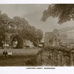
> Newburgh
> Map Marketing
> Postcode Sector Maps
> SN - Swindon
MADE IN THE USA
Safe Shipping with 30 Day Money Back Guarantee
FREE PERSONALISATION*
We are proud to offer a range of customisation features including Personalised Captions, Color Filters and Picture Zoom Tools
SECURE PAYMENTS
We happily accept a wide range of payment options so you can pay for the things you need in the way that is most convenient for you
* Options may vary by product and licensing agreement. Zoomed Pictures can be adjusted in the Cart.