Home > Animals > Fishes > S > Swallower
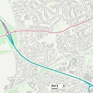
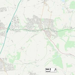
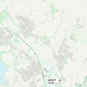
Leicester LE67 8 Map

![]()
Wall Art and Photo Gifts from Map Marketing
Leicester LE67 8 Map
Postcode Sector Map of Leicester LE67 8
Media ID 19974076
Anchor Lane Ashby Road Badgers Croft Booth Road Bottom Road Brook Lane Church Hill Church Lane Church Town Clay Lane Elm Close Field Close Forrester Close Glebe Road Griffin Road Hawthorn Rise Heathfield Homestead Road Hospital Lane John Street Johnson Close Jones Close Lavender Walk Le67 Leicester Loughborough Road Main Street Meadow Lane Melbourne Road Melrose Road Middle Road Mill Lane Moor Lane New Close New Road Nottingham Road Old Bakery Close Overton Close Pitt Lane Priory Close Railway Terrace Redhill Lane School Lane Spring Lane Springfield St Andrews Close Station Hill Stoney Lane The Green The Moor The Moorlands The Orchards The Sidings Tithe Close Top Road Valley View Vicarage Close Newbold Sinope St Georges Hill Swannington
FEATURES IN THESE COLLECTIONS
> Animals
> Fishes
> S
> Swallower
> Arts
> Artists
> A
> George Henry Andrews
> Arts
> Artists
> A
> Henry Andrews
> Arts
> Artists
> B
> John Brooks
> Arts
> Artists
> C
> Henry Clay
> Arts
> Artists
> E
> John Elder
> Arts
> Artists
> F
> John Field
> Arts
> Artists
> H
> John Hillers
> Arts
> Artists
> H
> John Hills
> Arts
> Artists
> J
> George Jones
> Map Marketing
> Postcode Sector Maps
> LE - Leicester
MADE IN THE USA
Safe Shipping with 30 Day Money Back Guarantee
FREE PERSONALISATION*
We are proud to offer a range of customisation features including Personalised Captions, Color Filters and Picture Zoom Tools
SECURE PAYMENTS
We happily accept a wide range of payment options so you can pay for the things you need in the way that is most convenient for you
* Options may vary by product and licensing agreement. Zoomed Pictures can be adjusted in the Cart.