Home > Arts > Artists > O > Oceanic Oceanic
EXPL2A-00353

![]()
Wall Art and Photo Gifts from North Wind
EXPL2A-00353
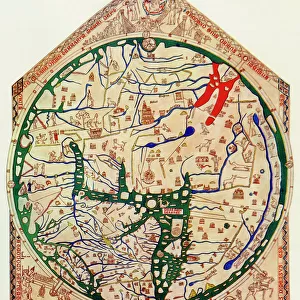
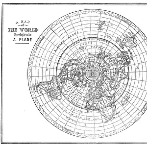
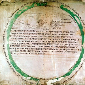
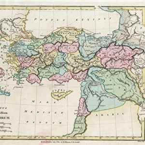
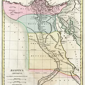
Ptolemys map of the world shown in red, true locations in black.
Printed color lithograph 19th century
North Wind Picture Archives brings history to life with stock images and hand-colored illustrations
Media ID 5881950
© North Wind Picture Archives
Africa Asia Cartography Earth Europe Flat Earth Medieval Mediterranean Mid East Middle Ages Navigation Ocean World World Map Claudius Ptolemaeus Flat Mappa Mundi Ptolemy
FEATURES IN THESE COLLECTIONS
> Africa
> Related Images
> Arts
> Art Movements
> Medieval Art
> Arts
> Artists
> O
> Oceanic Oceanic
> Asia
> Related Images
> Maps and Charts
> Flat Earth
> Maps and Charts
> Related Images
> Maps and Charts
> World
> North Wind Picture Archives
> Maps
EDITORS COMMENTS
This vintage print showcases Ptolemy's map of the world, a true gem from the 19th century. The intricate details are brought to life through the use of red for Ptolemy's depiction and black for the accurate locations. This color lithograph is a testament to the artistry and craftsmanship of that era. Transport yourself back in time as you gaze upon this historic piece. It takes you on a journey through medieval cartography, where navigation was an art form and exploration was at its peak. The illustration captures not only Earth's continents but also highlights the vastness of our oceans. The Mediterranean Sea stands out prominently, reminding us of its historical significance as a hub for trade and civilization during ancient times. Africa, Asia, and Europe take center stage on this map, showcasing their importance in shaping human history. As you delve into every corner of this artwork, it becomes evident that it is more than just a map; it is an embodiment of knowledge passed down through generations. Its presence evokes curiosity about how people perceived our world centuries ago. Step into the Middle Ages with this mesmerizing print – let your imagination wander across lands unknown and marvel at Claudius Ptolemaeus' contribution to cartography. Whether you are an avid historian or simply appreciate beautiful art pieces, this mappa mundi will surely captivate your senses with its rich history and timeless beauty.
MADE IN THE USA
Safe Shipping with 30 Day Money Back Guarantee
FREE PERSONALISATION*
We are proud to offer a range of customisation features including Personalised Captions, Color Filters and Picture Zoom Tools
SECURE PAYMENTS
We happily accept a wide range of payment options so you can pay for the things you need in the way that is most convenient for you
* Options may vary by product and licensing agreement. Zoomed Pictures can be adjusted in the Cart.