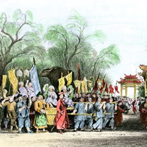
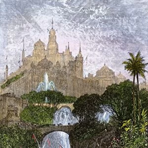
Home > Animals > Mammals > Didelphidae > Formosa
EVNT2A-00313

![]()
Wall Art and Photo Gifts from North Wind
EVNT2A-00313
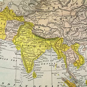
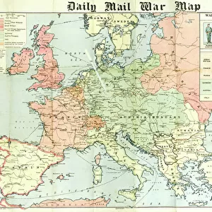
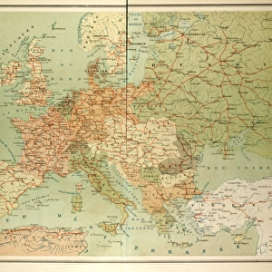
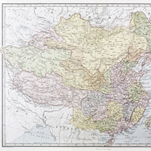
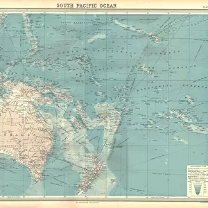
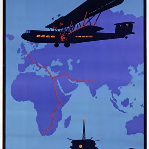
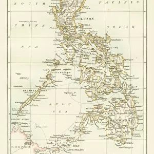
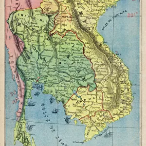
Map of the China Seas, Philippines, and European colonies in the region, 1898.
Printed color lithograph 19th century
North Wind Picture Archives brings history to life with stock images and hand-colored illustrations
Media ID 5881411
© North Wind Picture Archives
1890s 1898 Asia Colonial Colonialism Colony Imperialism Indonesia Island Japan Java Ocean Oceania Pacific Pacific Ocean Philippines Southeast Asia Spanish American War Territory Annam Borneo Cambodia China Sea Formosa French Indochina Indo China New Guinea Siam Sumatra
FEATURES IN THESE COLLECTIONS
> Animals
> Mammals
> Didelphidae
> Formosa
> Asia
> Philippines
> Maps
> North Wind Picture Archives
> India & Asia
EDITORS COMMENTS
This stunning vintage print, titled "EVNT2A-00313 (Map of the China Seas, Philippines, and European colonies in the region, 1898)" takes us back to a pivotal moment in history. Printed as a color lithograph during the 19th century, this illustration showcases the vast expanse of Southeast Asia's colonial territories. The map encompasses an array of significant locations such as Japan, Thailand, Indonesia, Vietnam, Sumatra, Java, Formosa (now Taiwan), Siam (modern-day Thailand), Borneo, Annam (Vietnam), Cambodia and more. It provides a comprehensive view of how various European powers had established their dominance over these lands during that time period. As we explore this piece further, it becomes apparent that it holds immense historical value. The year 1898 marks not only the Spanish-American War but also a turning point for imperialism and colonialism in Asia. This map serves as a visual representation of the geopolitical landscape at that precise moment. With its intricate details and vibrant colors brought to life through lithography techniques from over a century ago; this artwork transports us back to an era when empires clashed across oceans. It allows us to reflect on the complex interplay between nations and cultures throughout Southeast Asia's rich history. Whether you are an art enthusiast or someone fascinated by history and geopolitics alike; this remarkable print is sure to captivate your imagination with its depiction of past power dynamics in one of the world's most diverse regions
MADE IN THE USA
Safe Shipping with 30 Day Money Back Guarantee
FREE PERSONALISATION*
We are proud to offer a range of customisation features including Personalised Captions, Color Filters and Picture Zoom Tools
SECURE PAYMENTS
We happily accept a wide range of payment options so you can pay for the things you need in the way that is most convenient for you
* Options may vary by product and licensing agreement. Zoomed Pictures can be adjusted in the Cart.