Home > Europe > United Kingdom > England > London > River Thames
River Thames

![]()
Wall Art and Photo Gifts from Mary Evans Picture Library
River Thames
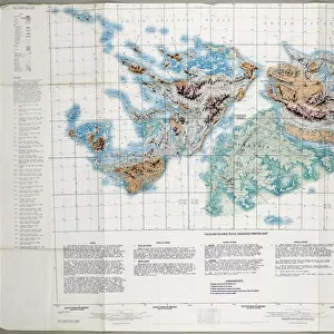
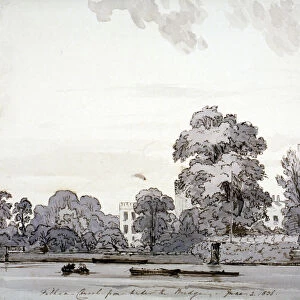
1947 River Thames flooding Catchment Area Map Date: 1947
Mary Evans Picture Library makes available wonderful images created for people to enjoy over the centuries
Media ID 7403269
© Mary Evans Picture Library 2015 - https://copyrighthub.org/s0/hub1/creation/maryevans/MaryEvansPictureID/10474688
FEATURES IN THESE COLLECTIONS
> Animals
> Mammals
> Muridae
> Fortior
> Arts
> Landscape paintings
> Waterfall and river artworks
> River artworks
> Europe
> United Kingdom
> England
> London
> River Thames
> Maps and Charts
> Related Images
> Mary Evans Prints Online
> National Archives
EDITORS COMMENTS
This historic map, dating back to 1947, depicts the River Thames and its surrounding catchment area during a period of significant flooding. The map, which was created in the aftermath of the devastating floods that hit England in the late 1940s, highlights the various tributaries and waterways that feed into the River Thames, providing a detailed overview of the extensive network of waterways that make up this iconic English waterway. The map offers a fascinating glimpse into a pivotal moment in the history of the River Thames and its surrounding areas. The flooding during the 1940s was a major event, causing widespread damage and disruption to communities and infrastructure. The map was likely used by emergency services, local authorities, and engineers to assess the extent of the damage and plan recovery efforts. The map also serves as a reminder of the importance of understanding the complex hydrological systems that underpin our waterways and the potential risks they pose during periods of heavy rainfall and flooding. The River Thames and its tributaries have a rich and complex history, and this map provides a unique perspective on the interconnected waterways that make up this vital part of England's natural and cultural heritage. The intricate detail of the map, with its clear labeling of various tributaries and waterways, offers a fascinating insight into the geography of the area and the ways in which the natural environment shapes the human landscape. The map also serves as a reminder of the importance of preserving and protecting our waterways, not just for their ecological value, but also for the vital role they play in our communities and our history.
MADE IN THE USA
Safe Shipping with 30 Day Money Back Guarantee
FREE PERSONALISATION*
We are proud to offer a range of customisation features including Personalised Captions, Color Filters and Picture Zoom Tools
SECURE PAYMENTS
We happily accept a wide range of payment options so you can pay for the things you need in the way that is most convenient for you
* Options may vary by product and licensing agreement. Zoomed Pictures can be adjusted in the Cart.