Home > Europe > Norway > Maps
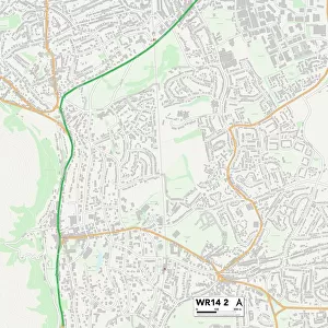
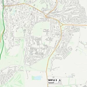
Malvern Hills WR13 5 Map

![]()
Wall Art and Photo Gifts from Map Marketing
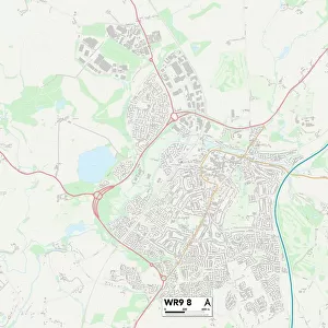
Malvern Hills WR13 5 Map
Postcode Sector Map of Malvern Hills WR13 5
Media ID 19980796
Beech Close Birchwood Drive Birchwood Lane Britannia Way Brookside Chapel Close Chapel Lane Chequers Close Coombe Lane Elmhurst Close Gloucester Drive Greenhill Ham Green Hawthorn Lane Kiln Lane Lynn Close Malvern Road Mansfield Road Maple Road Mayfield Road Newland North End Lane Oaklands Old School Close Pear Tree Drive Rectory Lane Spruce Close Stocks Lane Sycamore Close Tanhouse Lane Townsend Way Waterloo Close Wells Lane Westfield Windsor Close Worcester Road Cradley Huntingdon Madresfield Malvern Hills
FEATURES IN THESE COLLECTIONS
> Animals
> Birds
> Passerines
> Finches
> Related Images
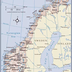
> Europe
> Norway
> Related Images
> Map Marketing
> Postcode Sector Maps
> WR - Worcester
> Maps and Charts
> Related Images
MADE IN THE USA
Safe Shipping with 30 Day Money Back Guarantee
FREE PERSONALISATION*
We are proud to offer a range of customisation features including Personalised Captions, Color Filters and Picture Zoom Tools
SECURE PAYMENTS
We happily accept a wide range of payment options so you can pay for the things you need in the way that is most convenient for you
* Options may vary by product and licensing agreement. Zoomed Pictures can be adjusted in the Cart.