Home > Europe > United Kingdom > England > London > Boroughs > Barnet
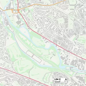
Leeds LS12 1 Map

![]()
Wall Art and Photo Gifts from Map Marketing
Leeds LS12 1 Map
Postcode Sector Map of Leeds LS12 1
Media ID 19974892
Amberley Road Barnet Road Bruce Gardens Cedar Avenue Cedar Close Cedar Place Cedar Road Cedar Street Chelsea Close Cheltenham Street Church Road Coleman Street Eighth Avenue First Avenue Goodwin Road Grasmere Close Grasmere Road Green Lane Hall Road Hawkhurst Road Kilburn Road Lawson Street Leeds Mill Green Mitford Road Oak Road Percy Street Portland Road Radnor Street Rosemary Avenue Second Avenue Shoreham Road Springwell Road St Bartholomews Close St Marys Close Stanley Terrace Stocks Hill Strawberry Lane Sutherland Street Sutton Street Third Avenue Thornhill Road Wellington Road Wesley Avenue Wesley Road Whitehall Whitehall Place
FEATURES IN THESE COLLECTIONS
> Europe
> United Kingdom
> England
> London
> Boroughs
> Barnet
> Europe
> United Kingdom
> Scotland
> Dumfries and Galloway
> Thornhill
> Europe
> United Kingdom
> Scotland
> Sutherland
> Map Marketing
> Postcode Sector Maps
> LS - Leeds
> Maps and Charts
> Related Images
MADE IN THE USA
Safe Shipping with 30 Day Money Back Guarantee
FREE PERSONALISATION*
We are proud to offer a range of customisation features including Personalised Captions, Color Filters and Picture Zoom Tools
SECURE PAYMENTS
We happily accept a wide range of payment options so you can pay for the things you need in the way that is most convenient for you
* Options may vary by product and licensing agreement. Zoomed Pictures can be adjusted in the Cart.