Home > Europe > United Kingdom > England > London > Boroughs > Croydon
Croydon CR2 6 Map

![]()
Wall Art and Photo Gifts from Map Marketing
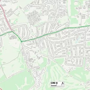
Croydon CR2 6 Map
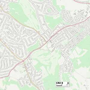
Postcode Sector Map of Croydon CR2 6
Media ID 19968021
Avondale Road Blenheim Crescent Bramley Close Brighton Road Churchill Road Cliffe Road Coningsby Road Croydon Edgehill Road Elder Place Heath Close Jarvis Road Junction Road Knighton Close Lambourn Close Mansfield Place Mansfield Road Marlborough Road Montpelier Road Newark Road Nottingham Road St Augustines Avenue Sussex Road Upland Road Warham Road Drovers Road Vauxhall Gardens
FEATURES IN THESE COLLECTIONS
> Animals
> Mammals
> Muridae
> Heath Mouse
> Europe
> United Kingdom
> England
> Avon
> Europe
> United Kingdom
> England
> London
> Boroughs
> Croydon
> Europe
> United Kingdom
> England
> Sussex
> Brighton
> Europe
> United Kingdom
> England
> Sussex
> Related Images
> Europe
> United Kingdom
> Scotland
> Perth and Kinross
> Blackford
> Europe
> United Kingdom
> Wales
> Powys
> Knighton
> Map Marketing
> Postcode Sector Maps
> CR - Croydon
> Maps and Charts
> Related Images
MADE IN THE USA
Safe Shipping with 30 Day Money Back Guarantee
FREE PERSONALISATION*
We are proud to offer a range of customisation features including Personalised Captions, Color Filters and Picture Zoom Tools
SECURE PAYMENTS
We happily accept a wide range of payment options so you can pay for the things you need in the way that is most convenient for you
* Options may vary by product and licensing agreement. Zoomed Pictures can be adjusted in the Cart.