Home > Europe > United Kingdom > England > Birmingham > Area > Shard End
Birmingham B34 7 Map

![]()
Wall Art and Photo Gifts from Map Marketing
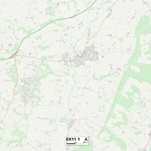
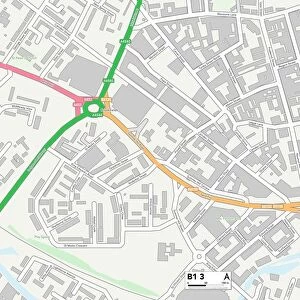
Birmingham B34 7 Map
Postcode Sector Map of Birmingham B34 7
Media ID 19964968
Birmingham Bradley Road Hurst Lane Lamb Close Lomond Close Melbourne Road Roebuck Close School Drive Tanglewood Close York Crescent
FEATURES IN THESE COLLECTIONS
> Europe
> United Kingdom
> England
> Birmingham
> Area
> Shard End
> Map Marketing
> Postcode Sector Maps
> B - Birmingham
> Maps and Charts
> Related Images
MADE IN THE USA
Safe Shipping with 30 Day Money Back Guarantee
FREE PERSONALISATION*
We are proud to offer a range of customisation features including Personalised Captions, Color Filters and Picture Zoom Tools
SECURE PAYMENTS
We happily accept a wide range of payment options so you can pay for the things you need in the way that is most convenient for you
* Options may vary by product and licensing agreement. Zoomed Pictures can be adjusted in the Cart.