Home > Europe > Malta > Maps
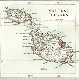
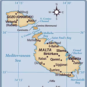
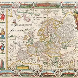
1762, Homann Heirs Map of Sicily, Sardenia, Corsica and Malta, ITALY, topography

![]()
Wall Art and Photo Gifts from Liszt Collection
1762, Homann Heirs Map of Sicily, Sardenia, Corsica and Malta, ITALY, topography
1762, Homann Heirs Map of Sicily, Sardenia, Corsica and Malta, ITALY
Liszt Collection of nineteenth-century engravings and images to browse and enjoy
Media ID 14004632
© Artokoloro Quint Lox Limited
1762 Antique Map Atlas Chart Geographic Latitude Longitude Mappa Mundi Old Antique Plan Old Antique View Old Map Ols Antique Map Rare Old Maps Topo
FEATURES IN THESE COLLECTIONS
> Europe
> Italy
> Sicily
> Related Images
> Maps and Charts
> Early Maps
> Maps and Charts
> Italy
> Maps and Charts
> Malta
> Maps and Charts
> World
EDITORS COMMENTS
This print showcases the Homann Heirs Map of Sicily, Sardenia, Corsica and Malta from 1762. A true masterpiece of cartography, this vintage map offers a glimpse into the rich history and topography of Italy's enchanting islands. With its intricate details and precise measurements, it serves as both an illustration and a guide to the geographic wonders of this region. The carefully drawn lines depict latitude and longitude coordinates, forming a grid that aids in navigation across these ancient lands. The geometric precision employed by the mapmaker is truly remarkable, highlighting their dedication to accuracy in representing the world as they knew it during that time. As we gaze upon this aged piece of art, we are transported back in time to an era when exploration and discovery were at their peak. It evokes a sense of wonderment about past journeys taken by intrepid explorers who ventured through these territories. Adorned with decorative elements that add charm to its historical significance, this rare old map holds immense value for collectors and enthusiasts alike. Its presence reminds us of our connection to Earth's past while igniting our curiosity about how much has changed since then. The Liszt Collection beautifully captures the essence of this antique treasure through their expertly crafted photo print. It allows us to appreciate not only its artistic appeal but also its educational value as a window into centuries gone by.
MADE IN THE USA
Safe Shipping with 30 Day Money Back Guarantee
FREE PERSONALISATION*
We are proud to offer a range of customisation features including Personalised Captions, Color Filters and Picture Zoom Tools
SECURE PAYMENTS
We happily accept a wide range of payment options so you can pay for the things you need in the way that is most convenient for you
* Options may vary by product and licensing agreement. Zoomed Pictures can be adjusted in the Cart.