Home > Arts > Landscape paintings > Waterfall and river artworks > River artworks
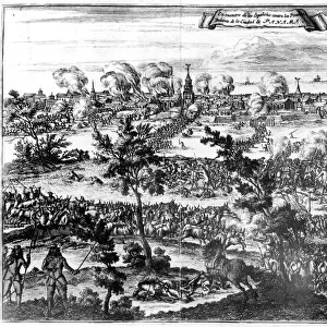
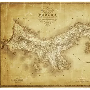
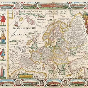
PANAMA: SETTLEMENT, 1541. Map of Nombre de Dios, Panama, established by the Spanish

![]()
Wall Art and Photo Gifts from Granger
PANAMA: SETTLEMENT, 1541. Map of Nombre de Dios, Panama, established by the Spanish
PANAMA: SETTLEMENT, 1541.
Map of Nombre de Dios, Panama, established by the Spanish in 1510 as a transshipment center for gold and silver from Peru. Drawing, 1541
Granger holds millions of images spanning more than 25,000 years of world history, from before the Stone Age to the dawn of the Space Age
Media ID 12416064
1510 1541 Bradley Smith Colonial Colony Gold Harbor Latin America Latin American Panama Panamanian Port Settlement Ship Silver Spanish Trade Transport
FEATURES IN THESE COLLECTIONS
> Arts
> Landscape paintings
> Waterfall and river artworks
> River artworks
> Granger Art on Demand
> World History
> Maps and Charts
> Early Maps
> Maps and Charts
> World
> North America
> Panama
> Maps
> South America
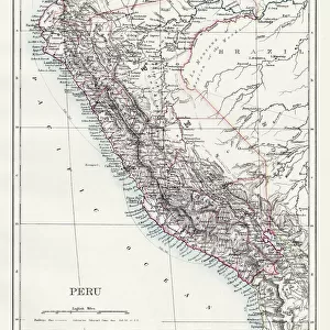
> Peru
> Maps
EDITORS COMMENTS
This print showcases a historic moment in Panama's colonial history. The image depicts a map of Nombre de Dios, a significant settlement established by the Spanish in 1510. Serving as a crucial transshipment center for gold and silver from Peru, this port city played an essential role in facilitating trade and transportation during that era. The drawing itself dates back to 1541, offering us a glimpse into the early years of Panama's development. Its intricate details capture the exterior features of Nombre de Dios, including its bustling harbor where ships would dock to load precious cargo. This maritime hub served as a vital link between Latin America and Europe, enabling the exchange of goods and resources across continents. As we admire this piece from Bradley Smith's Carousel Collection, we are transported back in time to witness the thriving colonial atmosphere that once characterized Panama. The map not only highlights the strategic location of Nombre de Dios along the river but also emphasizes its significance as a gateway for Spanish exploration and conquest. Through this remarkable artwork, we can appreciate both the historical importance of Panama as well as its enduring legacy within Latin American history.
MADE IN THE USA
Safe Shipping with 30 Day Money Back Guarantee
FREE PERSONALISATION*
We are proud to offer a range of customisation features including Personalised Captions, Color Filters and Picture Zoom Tools
SECURE PAYMENTS
We happily accept a wide range of payment options so you can pay for the things you need in the way that is most convenient for you
* Options may vary by product and licensing agreement. Zoomed Pictures can be adjusted in the Cart.