Home > North America > United States of America > Maps
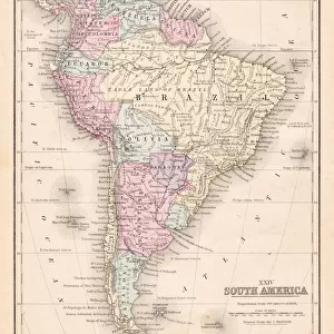
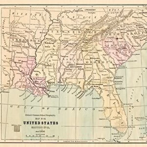
Map of north states USA 1896

![]()
Wall Art and Photo Gifts from Fine Art Storehouse
Map of north states USA 1896
Andres Allgemeiner Handatlas - Bielefeld und Leipzig 1896
Unleash your creativity and transform your space into a visual masterpiece!
THEPALMER
Media ID 18356805
FEATURES IN THESE COLLECTIONS
> Fine Art Storehouse
> Map
> Historical Maps
> Fine Art Storehouse
> Map
> USA Maps
> Maps and Charts
> Related Images
> North America
> United States of America
> Maps
EDITORS COMMENTS
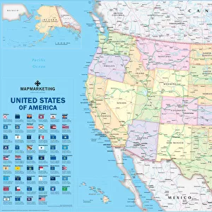
In this print titled "Map of north states USA 1896" we are transported back in time to an era when cartography was both a science and an art form. The image, sourced from the Andres Allgemeiner Handatlas published in Bielefeld und Leipzig in 1896, offers us a glimpse into the intricate details and craftsmanship that went into creating maps during that period. As we gaze upon this vintage map, our eyes are immediately drawn to the rich colors and meticulous illustrations depicting the northern states of the United States. Every contour line, river system, and mountain range has been carefully etched onto paper with utmost precision. It is as if we can almost feel the dedication and expertise of those cartographers who meticulously crafted this piece over a century ago. The Map of north states USA 1896 allows us to appreciate not only its historical significance but also its aesthetic beauty. Its delicate lines and ornate typography evoke a sense of nostalgia for a bygone era when maps were cherished objects meant to be studied and admired. This print by THEPALMER captures all these elements flawlessly, inviting us to explore history through art. Whether displayed on your office wall or added to your collection at home, it serves as a reminder of how far we have come in understanding our world while honoring the timeless allure of antique maps.
MADE IN THE USA
Safe Shipping with 30 Day Money Back Guarantee
FREE PERSONALISATION*
We are proud to offer a range of customisation features including Personalised Captions, Color Filters and Picture Zoom Tools
SECURE PAYMENTS
We happily accept a wide range of payment options so you can pay for the things you need in the way that is most convenient for you
* Options may vary by product and licensing agreement. Zoomed Pictures can be adjusted in the Cart.