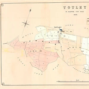
Home > Maps and Charts > Early Maps
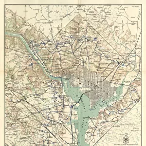
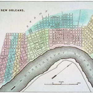
Early Map of the City and Capitol of Washington, D. C. United States, Antique American Illustration, 1900

![]()
Wall Art and Photo Gifts from Fine Art Storehouse
Early Map of the City and Capitol of Washington, D. C. United States, Antique American Illustration, 1900
Antique American Photograph: Early Map of the City and Capitol of Washington, D.C. United States, Antique American Illustration, 1900: Original edition from my own archives. Copyright has expired on this artwork. Digitally restored. Historic maps of the city were featured in 1900 as part of the Washington D.C. Centennial Celebration
Unleash your creativity and transform your space into a visual masterpiece!
bauhaus1000
Media ID 15286875
© This content is subject to copyright
FEATURES IN THESE COLLECTIONS
> Fine Art Storehouse
> Map
> Historical Maps
> Fine Art Storehouse
> Map
> Map Illustrations
> Maps and Charts
> Early Maps
EDITORS COMMENTS
This print showcases an early map of the city and Capitol of Washington, D. C. , dating back to 1900. A true antique American illustration, this original edition has been carefully preserved in the archives of bauhaus1000. With its copyright expired, this artwork has been digitally restored to its former glory. The map takes us on a journey through time, offering a glimpse into the rich history of our nation's capital. As part of the Washington D. C. Centennial Celebration in 1900, historic maps like these were prominently featured, reminding residents and visitors alike of the city's remarkable past. Every intricate detail is captured in this print - from the winding streets that crisscrossed the city to the iconic landmarks such as the Capitol building itself. The meticulous craftsmanship evident in this illustration transports us back to a bygone era when horse-drawn carriages traversed these very roads. As we gaze upon this piece, we can't help but marvel at how much Washington D. C. has evolved over time while still retaining its timeless charm. This photograph serves as a testament to both our nation's progress and enduring heritage. Whether you are an avid history enthusiast or simply appreciate fine art with historical significance, this exquisite print will undoubtedly become a cherished addition to your collection. Let it transport you back in time and ignite your imagination as you explore the early days of one of America's most beloved cities.
MADE IN THE USA
Safe Shipping with 30 Day Money Back Guarantee
FREE PERSONALISATION*
We are proud to offer a range of customisation features including Personalised Captions, Color Filters and Picture Zoom Tools
SECURE PAYMENTS
We happily accept a wide range of payment options so you can pay for the things you need in the way that is most convenient for you
* Options may vary by product and licensing agreement. Zoomed Pictures can be adjusted in the Cart.