Home > Maps and Charts > World
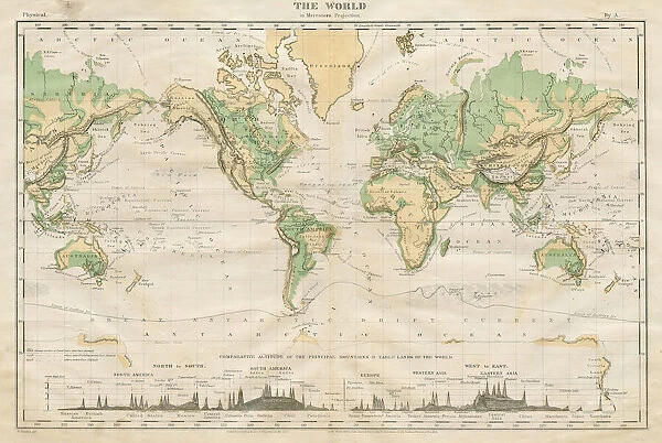
Commercial Map of the World 1868
![]()

Wall Art and Photo Gifts from Fine Art Storehouse
Commercial Map of the World 1868
Guyots The Earth Common School Geography - 1868
Unleash your creativity and transform your space into a visual masterpiece!
THEPALMER
Media ID 21177711
© A 2014 Roberto Adrian Photography
FEATURES IN THESE COLLECTIONS
> Fine Art Storehouse
> Map
> Historical Maps
> Maps and Charts
> Related Images
> Maps and Charts
> World
EDITORS COMMENTS
In this print titled "Commercial Map of the World 1868" we are transported back in time to an era when cartography was both a science and an art form. Created by THEPALMER, this particular map is derived from Guyot's The Earth Common School Geography - 1868, showcasing the intricate details and craftsmanship that went into producing maps during the late 19th century. The image captures our attention with its rich colors and meticulous design. Every corner of the world is meticulously depicted, allowing us to explore continents, oceans, and countries as they were known over a century ago. It serves as a reminder of how much our understanding of geography has evolved since then. This historical piece not only provides geographical information but also offers glimpses into global commerce at that time. The title itself suggests that it was created with commercial interests in mind. As we study the map closely, we can observe trade routes marked by dotted lines connecting major ports across different continents—a testament to the interconnectedness of nations even in those times. "The Commercial Map of the World 1868" invites us to appreciate both its artistic beauty and historical significance. It sparks curiosity about how people navigated vast distances without modern technology or satellite imagery. This print would be a perfect addition for history enthusiasts or anyone who appreciates vintage artwork that tells stories beyond what meets the eye.
MADE IN THE USA
Safe Shipping with 30 Day Money Back Guarantee
FREE PERSONALISATION*
We are proud to offer a range of customisation features including Personalised Captions, Color Filters and Picture Zoom Tools
SECURE PAYMENTS
We happily accept a wide range of payment options so you can pay for the things you need in the way that is most convenient for you
* Options may vary by product and licensing agreement. Zoomed Pictures can be adjusted in the Cart.


