Home > Maps and Charts > Early Maps
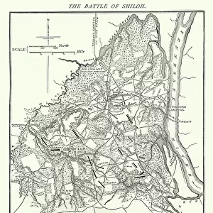
Antique Map of the Mackinac Island Area during the War of 1812 - 19th Century

![]()
Wall Art and Photo Gifts from Fine Art Storehouse
Antique Map of the Mackinac Island Area during the War of 1812 - 19th Century
Vintage map showing early territorial borders and military positions in the Mackinac area during the War of 1812. Vintage etching circa late 19th century
Unleash your creativity and transform your space into a visual masterpiece!
powerofforever
Media ID 15149731
© This content is subject to copyright
Territory War Of 1812 Fort Mackinac
FEATURES IN THESE COLLECTIONS
> Fine Art Storehouse
> History
> Battles & Wars
> Historcal Battle Maps and Plans
> Fine Art Storehouse
> Map
> Historical Maps
> Historic
> Battles
> Related Images
> Maps and Charts
> Early Maps
> Maps and Charts
> Related Images
EDITORS COMMENTS
This antique map print takes us back to the early 19th century, specifically during the tumultuous War of 1812. The intricate etching showcases the territorial borders and military positions in the Mackinac Island area, providing a fascinating glimpse into this pivotal period in American history. The map highlights Fort Mackinac and Fort Michilimackinac, two strategic strongholds that played significant roles during the war. These forts served as crucial outposts for both British and American forces, fiercely contested by both sides throughout the conflict. With meticulous detail, this vintage map offers a visual narrative of the Battle of Mackinac Island, a key engagement that took place in July 1814. It was during this battle that American forces successfully recaptured Fort Mackinac from British control after its capture earlier in the war. As we delve into this historical artifact, we are transported to an era where territorial disputes were settled through armed conflicts and military strategies shaped national boundaries. This print serves as a reminder of our nation's past struggles and triumphs while offering valuable insights into how our country evolved over time. Whether you are a history enthusiast or simply appreciate fine art with historical significance, this antique map print is sure to captivate your imagination and spark conversations about America's rich heritage.
MADE IN THE USA
Safe Shipping with 30 Day Money Back Guarantee
FREE PERSONALISATION*
We are proud to offer a range of customisation features including Personalised Captions, Color Filters and Picture Zoom Tools
SECURE PAYMENTS
We happily accept a wide range of payment options so you can pay for the things you need in the way that is most convenient for you
* Options may vary by product and licensing agreement. Zoomed Pictures can be adjusted in the Cart.