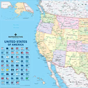
Home > North America > United States of America > New York > New York > Sights > New York Public Library
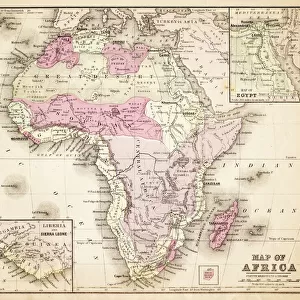
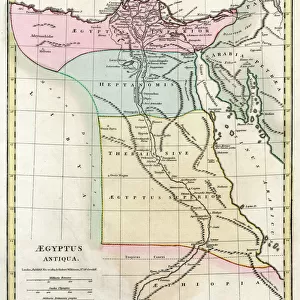
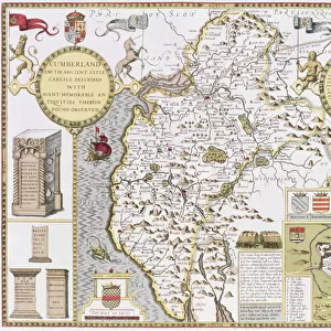
Map of Africa showing its most recent discoveries with the Island of St

![]()
Wall Art and Photo Gifts from Fine Art Finder
Map of Africa showing its most recent discoveries with the Island of St
XOS1765717 Map of Africa showing its most recent discoveries with the Island of St. Helena inset from Mitchells new general atlas, 1863 (colour engraving) by American School, (19th century); New York Public Library, USA; (add.info.: Published by S(amuel) Augustus Mitchell (1792-1868) ); American, out of copyright
Media ID 12742621
© www.bridgemanimages.com
Arabia Arabian Sea Atlantic Ocean Atlas Equator Hydrography Indian Ocean Navigation Sahara Desert Saint Helena Sea Chart Tropic Of Cancer Tropic Of Capricorn
FEATURES IN THESE COLLECTIONS
> Africa
> Related Images
> Animals
> Mammals
> Muridae
> Desert Mouse
> Arts
> Artists
> I
> Indian School Indian School
> Arts
> Artists
> O
> Oceanic Oceanic
> Fine Art Finder
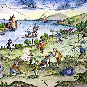
> Maps (celestial & Terrestrial)
> Fine Art Finder
> Schools
> American School
> Maps and Charts
> Related Images
> North America
> United States of America
> Maps
> North America
> United States of America
> New York
> New York
> Maps
> North America
> United States of America
> New York
> New York
> Sights
> New York Public Library
EDITORS COMMENTS
This print showcases a remarkable "Map of Africa showing its most recent discoveries with the Island of St. Helena" from Mitchell's new general atlas, dated back to 1863. Crafted by the American School in the 19th century, this color engraving is now housed at the New York Public Library in the USA. The map itself provides an intriguing glimpse into the world of cartography and navigation during that era. It depicts Africa's vast coastline, highlighting its most recent geographical findings and featuring an inset showcasing the Island of St. Helena. The attention to detail is evident as it illustrates various elements such as sea charts, hydrography, and maritime routes across both the Atlantic Ocean and Indian Ocean. As we explore this historical artifact further, we can observe significant landmarks like Arabia and Arabian Sea along with lesser-known regions within Africa's unknown interior. The Sahara Desert dominates a large portion of this continent while other notable lines on display include Tropic of Cancer, Tropic of Capricorn, and Equator. This print not only serves as a visual representation but also offers valuable insights into exploration during that time period. It reminds us how far our understanding has come since then while honoring Samuel Augustus Mitchell for his contribution to cartography through his publication efforts.
MADE IN THE USA
Safe Shipping with 30 Day Money Back Guarantee
FREE PERSONALISATION*
We are proud to offer a range of customisation features including Personalised Captions, Color Filters and Picture Zoom Tools
SECURE PAYMENTS
We happily accept a wide range of payment options so you can pay for the things you need in the way that is most convenient for you
* Options may vary by product and licensing agreement. Zoomed Pictures can be adjusted in the Cart.