Home > Maps and Charts > Gerardus Mercator's Cartographic
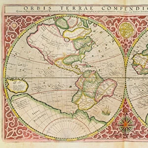
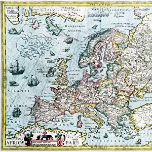
Double Hemisphere World Map, 1587 (coloured engraving)
")
![]()
Wall Art and Photo Gifts from Fine Art Finder
Double Hemisphere World Map, 1587 (coloured engraving)
XCF291083 Double Hemisphere World Map, 1587 (coloured engraving) by Mercator, Gerardus (1512-94); Private Collection; (add.info.: Orbis Terrae; Compendiosa Descriptio; ); Flemish, out of copyright
Media ID 12793547
© www.bridgemanart.com
Atlantic Atlas Compass Eastern Globe Indian Ocean Mapping North Pacific Mercator Projection Northern Renaissance Rumold
FEATURES IN THESE COLLECTIONS
> Fine Art Finder
> Artists
> Gerardus Mercator
> Fine Art Finder
> Maps (celestial & Terrestrial)
> Maps and Charts
> Gerardus Mercator's Cartographic
EDITORS COMMENTS
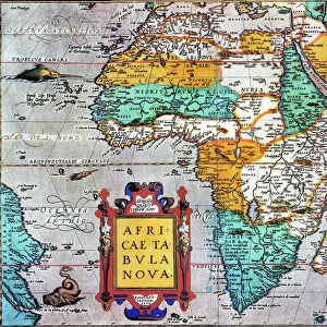
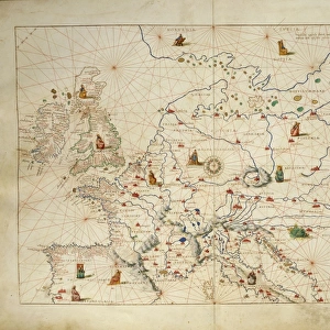
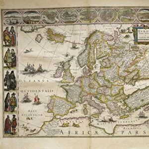
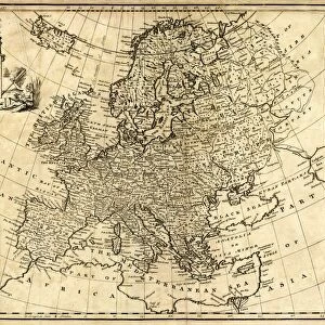
This print showcases the "Double Hemisphere World Map" created by Gerardus Mercator in 1587. With its vibrant colors and intricate details, this antique engraving takes us back to a time of great exploration and scientific discovery. The map depicts both the Western and Eastern Hemispheres, providing a comprehensive view of the world as it was known during Mercator's era. From Africa to South America, from Asia to Europe, every continent is meticulously illustrated with geographical accuracy. What makes this artwork even more fascinating are the celestial elements incorporated into it. Astronomical equipment can be seen scattered across the map, emphasizing the close relationship between cartography and astronomy during that period. The inclusion of rumold symbols adds an extra layer of mystique to this masterpiece. Mercator's use of his famous projection technique ensures that distances on land appear accurately proportioned on this map. This innovation revolutionized navigation for centuries to come. As we gaze upon this remarkable piece, we are transported back in time when explorers set sail across vast oceans armed with nothing but compasses and globes. It serves as a reminder of humanity's insatiable curiosity about our planet and our place within it. This print is not only a testament to Mercator's genius but also a celebration of Northern Renaissance artistry at its finest.
MADE IN THE USA
Safe Shipping with 30 Day Money Back Guarantee
FREE PERSONALISATION*
We are proud to offer a range of customisation features including Personalised Captions, Color Filters and Picture Zoom Tools
SECURE PAYMENTS
We happily accept a wide range of payment options so you can pay for the things you need in the way that is most convenient for you
* Options may vary by product and licensing agreement. Zoomed Pictures can be adjusted in the Cart.